Where Glaciers Flowed:
Bass Lake Trail, Bitterroot Mountains, Montana
June 14-16, 2005 • Shawn Naylor and Dick Gibson

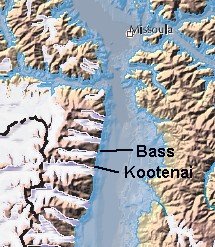
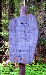 On this easy backpacking expedition into the Selway-Bitterroot Wilderness, I accompanied my friend Shawn as he did initial field locating of trimlines - the inferred upper limit of glaciation - in some of the prominent east-west U-shaped valleys on the east flank of the Bitterroot Mountains south of Missoula, Montana. Shawn's thesis compares erosion on north- and south-facing flanks of valleys, with the goal of inferring differences in glacial versus fluvial dominance in erosion. In most of Bass Creek Valley, the ice was easily 1500 to 2000 feet deep 20,000 years ago. The illustration, right, shows the northern Bitterroot Valley during Glacial Lake Missoula time (from USFS map of Glacial Lake Missoula). On this easy backpacking expedition into the Selway-Bitterroot Wilderness, I accompanied my friend Shawn as he did initial field locating of trimlines - the inferred upper limit of glaciation - in some of the prominent east-west U-shaped valleys on the east flank of the Bitterroot Mountains south of Missoula, Montana. Shawn's thesis compares erosion on north- and south-facing flanks of valleys, with the goal of inferring differences in glacial versus fluvial dominance in erosion. In most of Bass Creek Valley, the ice was easily 1500 to 2000 feet deep 20,000 years ago. The illustration, right, shows the northern Bitterroot Valley during Glacial Lake Missoula time (from USFS map of Glacial Lake Missoula).
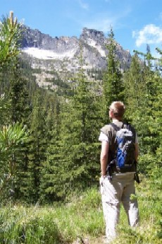
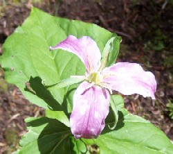
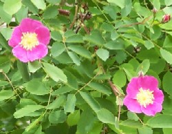
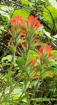
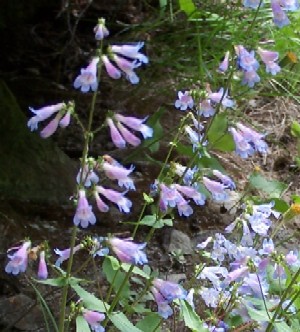
Mid-June is high spring or early summer in Montana, depending on your elevation. Wildflowers were at their peak in Bass Canyon. The weather was fine, though a bit cool - typical for this time of year. After our initial 5-mile hike, gaining 1300 feet, we established camp a few hundred yards off the trail, near some interesting dry (and one flowing) gullies. The flowing stream was a typical mountain freshet, full and rapid, coursing down from the rocky highlands into the floor of the U-shaped Bass Creek Valley, and then on to ultimately join Bass Creek below our camp. Within a couple feet of the flowing stream was a dry arroyo, no more than a foot or two deep and a foot or two wide. 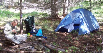 It seemed strange that it was dry, since it was in many places lower in elevation than the adjacent water-filled creek - but more on that later. It seemed strange that it was dry, since it was in many places lower in elevation than the adjacent water-filled creek - but more on that later.
It was still early, maybe 3:30 or 4:00, so we hiked a ways back down the trail for Shawn to climb the north slope where he could  establish some nick points using his GPS unit and topo maps. A quick hailstorm hit just as he was about to head up - fortunately we had remembered rain coats, and the forest was quite thick. The storm was short but intense, then the sun came out, illuminating pine and larch needles dripping water. establish some nick points using his GPS unit and topo maps. A quick hailstorm hit just as he was about to head up - fortunately we had remembered rain coats, and the forest was quite thick. The storm was short but intense, then the sun came out, illuminating pine and larch needles dripping water.
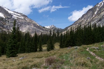
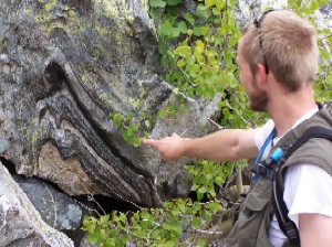
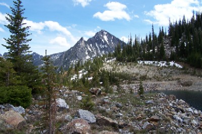
Next day was the main event - the hike up the low flank of a fine U-shaped valley to Bass Lake, a dam-enhanced cirque lake at the head of Bass Creek. It was only about 2 or 3 miles further up, but probably an additional gain of about 900 feet. The trail took us past ragged heights on the south and somewhat more subdued ridges on the north. This area is near the contact between the Idaho Batholith and the Proterozoic Belt rocks which it intrudes, so we found abundant granitic rock in the float, but as we progressed higher, the country rock became high-grade metamorphics, often highly contorted and folded, sometimes with large garnets and other metamorphic minerals.
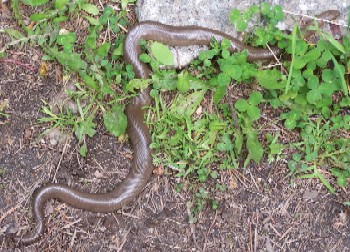
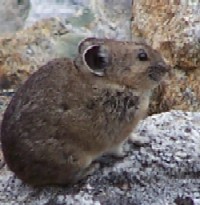
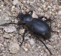
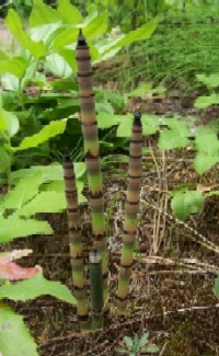
Although we had left our dogs Cody and Jackson at home for this expedition, we did encounter various life forms besides plants: snakes, bugs, and at the lake shore, a pika busy enjoying the summer plenty.
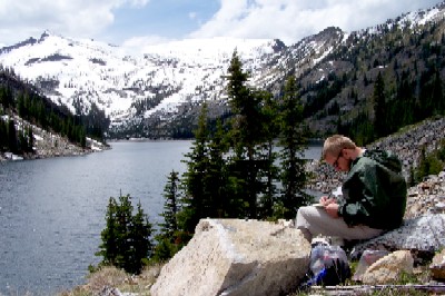
Snow was present in scattered shady places along the trail, but at Bass Lake, elevation about 7,000 feet, the headward cirque walls still lay thickly buried in snow. A beautiful place, where we had lunch and Shawn did some reconnaisance mapping taking advantage of the fine visability. Breezy and a bit chilly, again typical for this elevation in mid-June.
We were constantly on the lookout for specific glacial features, like striations and grooves, but the only spot we saw clear-cut examples was in the narrow notch just below Bass Lake Dam. Clearly the glacier had been tightly constricted here - but it still cut and polished some remarkable striated grooves in the granite (below left). The view down-valley from this point offered one of the best looks at this glacial valley (below right).
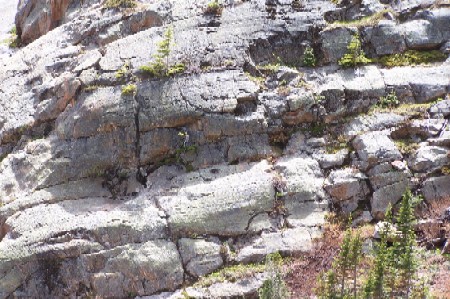 | 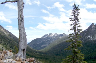 |
When we came out of Bass Creek Valley, we headed south to the next canyon - Kootenai Creek. Shawn hopes to look at enough of the 18 or more east-west valleys on the east flank of the Bitterroot for his work to have statistical significance. Kootenai Creek held more water than Bass Creek and the vegetation was even lusher than that in the canyon to the north. Wildflowers were everywhere, profuse and diverse. This trail is also quite a bit easier than Bass Canyon, so there were a lot more tourists hiking than we had encountered the day before (one person along Bass trail). Nonetheless the spectacular riverway and rampant flowers made for a fine end to this three-day tour.
So what about that tantalizing "more later" on the gullies near our campsite? Well, at dinner the first night, we suddenly noticed a new sound - the formerly bone-dry gully nearest us, 20 or 30 feet away, was suddenly flowing. We found the leading edge of flow, like a slow-motion flash-flood, slower here and there where the gradient became less. We followed it upstream a good distance, but never reached a head nor a place where the water of the other gully - barely 2 feet away at closest approach - might split to feed two gullies. Next morning our nearby gully was dry again. Our best explanation suggested an afternoon increase in snowmelt, overflowing at some upland location to fill both gullies; and Shawn speculated that the hydraulic separation between the two very close gullies might relate to impermeable materials in the soil that can result from forest fires (something being studied by one of Shawn's colleagues, Andy Bookter). Whatever the cause, it was a fascinating event.
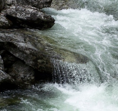 | 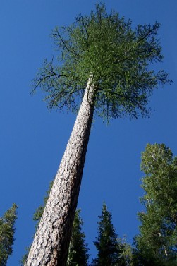 |
| Kootenai Creek | The Larch |
Back to Expeditions Page
|